marqueta.org
You can't always apt-get what you want
Infosec - Cycling - Estudiantes
RHCE / RHCSA
Once a sysadmin, always a sysadmin
Day 2: from Grañón to Fuente Sidres
25th May 2024
Even though I’m already on the journey, it’s hard for me to realize that I am once again on the Camino de Santiago. It happened to me in 2022 and it happened again this year. I suppose many circumstances contribute to this: from riding such familiar trails to sleeping in a hostel still close to home. But this changes on the second day.
At 7:15 in the morning, I set off. I can’t have breakfast at that time (there are some renovations at the hostel, and the kitchen isn’t available at that moment). They explained it to me the day before, but I preferred not to get up earlier or postpone my departure, so it was my decision.
I slowly cover the scarce two kilometers that separate me from Grañón, enjoying the incredible spectacle of the sunrise:
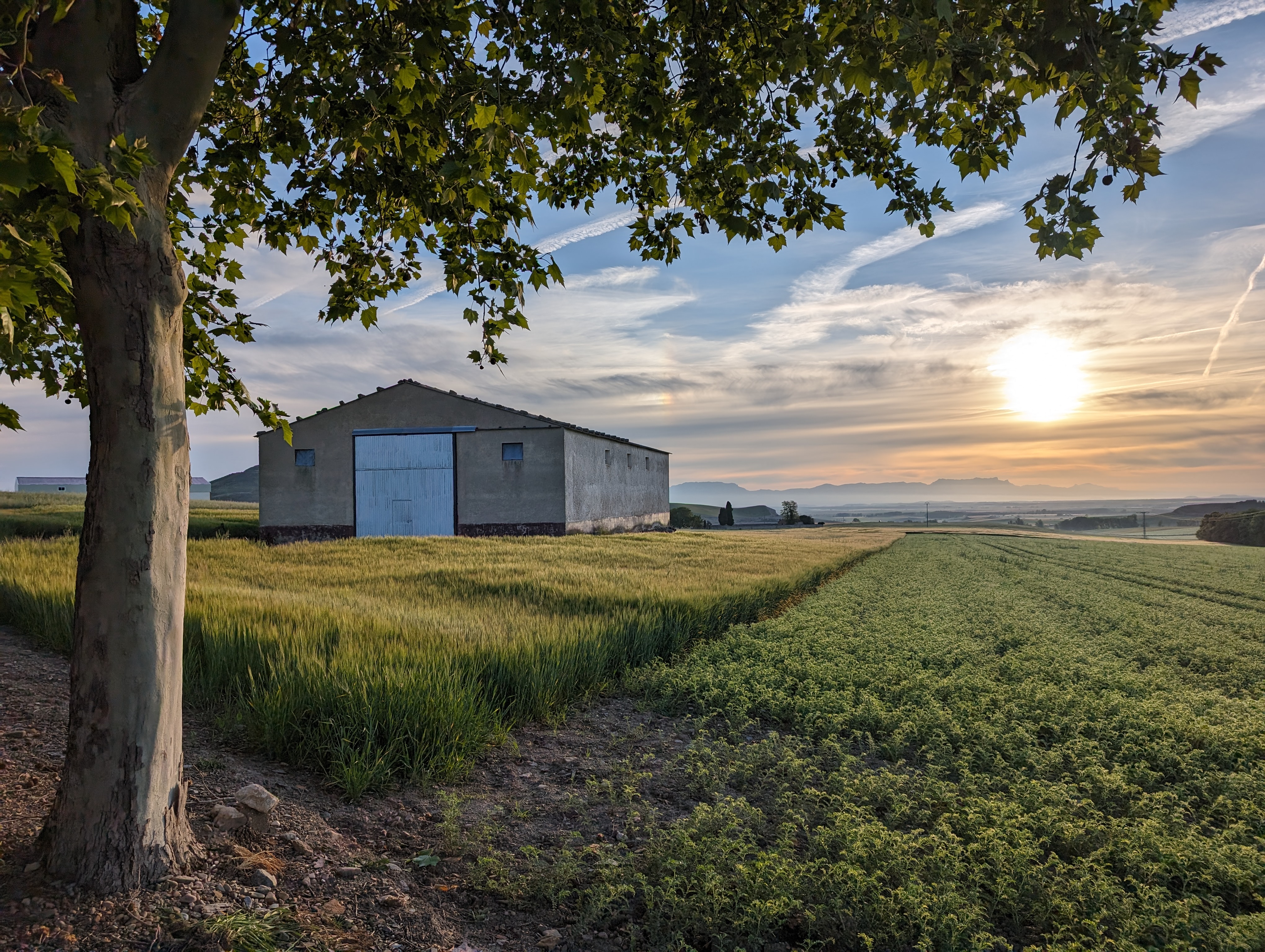
Sunrise in Grañón
Grañón is the last town in La Rioja on the Camino Francés. I ride through the village while the first pilgrims start to walk, get some water at the fountain, and advance to the viewpoint at the exit where a wide panorama of the province of Burgos.
The landscape has changed, and cereal crops have replaced vineyards; I leave La Rioja (entering what is called Riojilla Burgalesa) and the first town I encounter is Redecilla del Camino. I had thought about having breakfast there, but the bar was still closed, and honestly, I wasn’t in the mood. So I gulped down a gel, took a sip of water, and kept going.
Leaving Redecilla, I did one of my usual things; absorbed in thought, I got distracted for a moment, saw the tower of a church (possibly Bascuñana, which the Camino does not pass through), and headed toward it ignoring the omnipresent yellow arrows. Fortunately, I realized it quickly and turned back, though I had to cross a huge mud puddle. If I remember correctly, this was the only such mishap on this trip. Not bad for me!
Back on track, I noticed that the rear bag was rubbing against the wheel at times. In Castildelgado, I stopped to fix it; I simply hadn’t placed the inner bag correctly when packing in the morning.
The next village is Viloria de Rioja (which, despite the name, is in Burgos province). I stopped for a while to take photos next to the monument commemorating its most illustrious son, Santo Domingo de la Calzada, although his birthplace collapsed long ago.
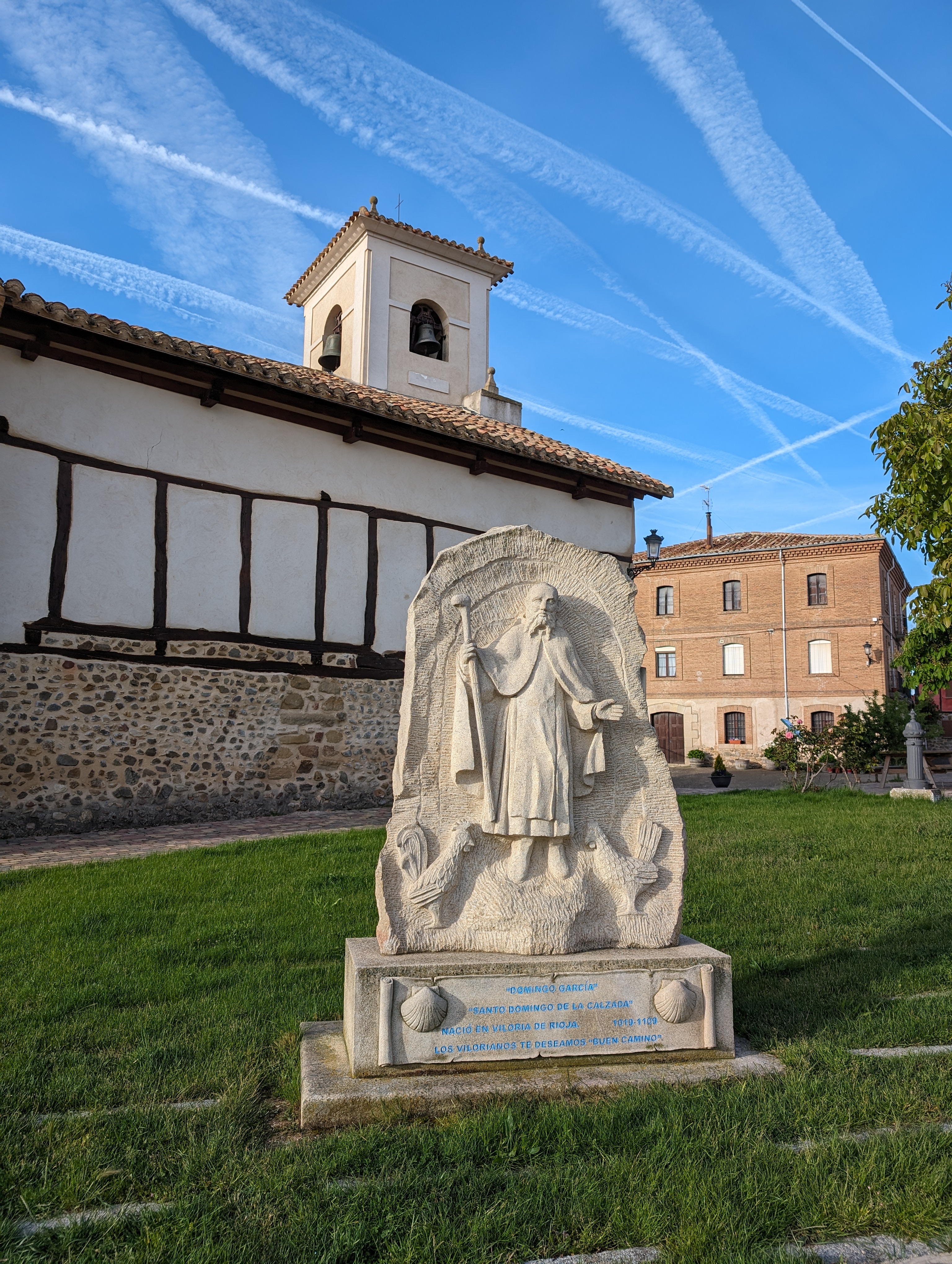
Viloria de Rioja
I continue on the path to Villamayor del Río and Belorado. Here I try again to find a place for breakfast, with little faith and little desire because, to be honest, I have no appetite. So I continue to Tosantos; there, at the entrance, is a small bar with some activity due to the pilgrims and I force myself to stop. Today is a tough day, and I can’t continue without eating.
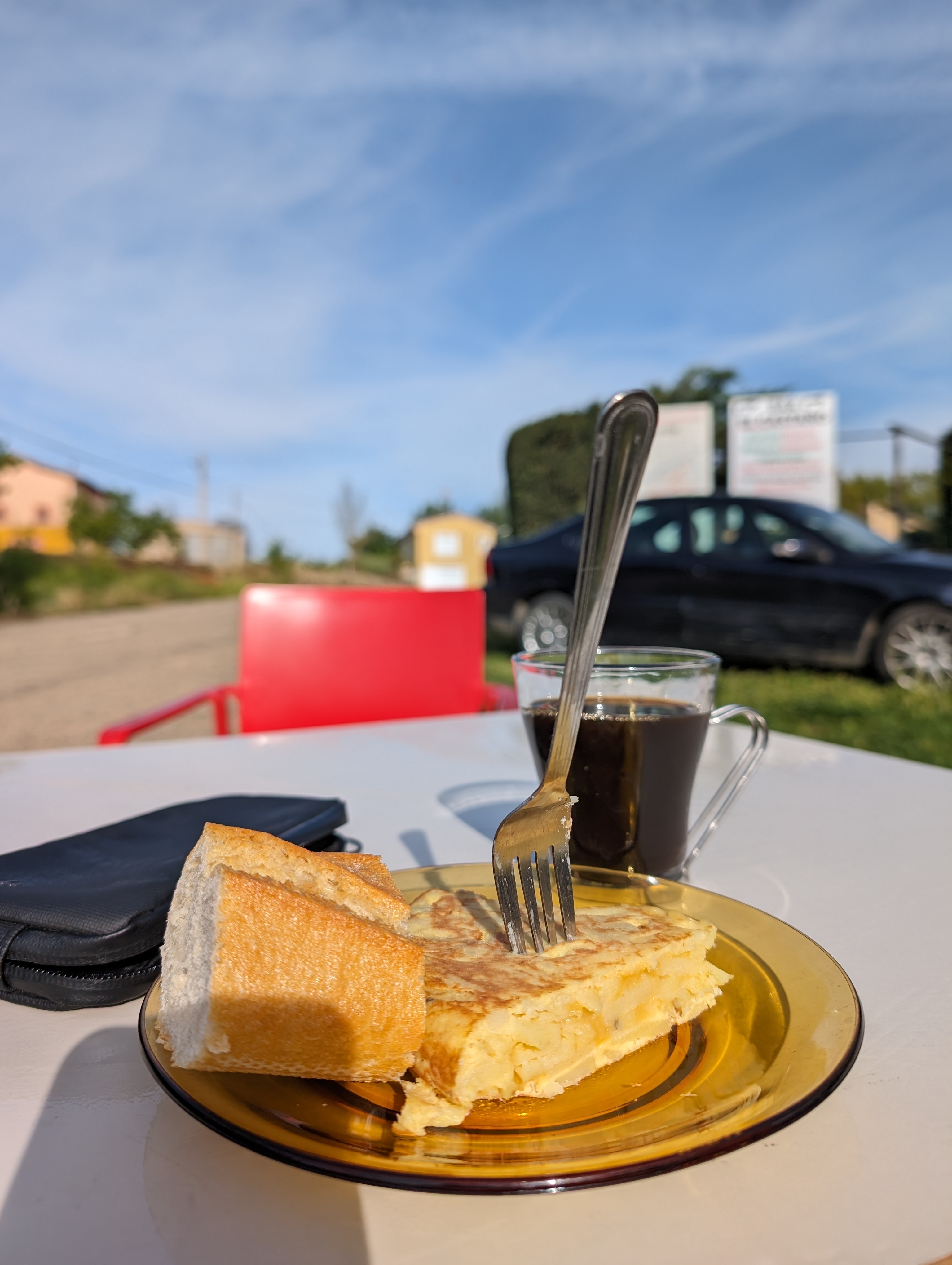
Pincho de tortilla en Tosantos
So, I have some orange juice, coffee and a tortilla de patata, which I can’t finish. For the first time, I engage in conversation with some pilgrims (mostly foreigners), among whom I remember an Irishman who was happy because finally, on his fourth Camino, he had managed to see the Michelangelo at the Logroño Cathedral.
Kilometers go by and I leave Villambistia and Espinosa del Camino behind. I approach Villafranca de Montes de Oca, where one of the most feared ascents of the Camino begins. Well, it was feared in the Middle Ages when it was plagued with bandits who would assault and rob pilgrims; now, at most, you can get sore legs from the steep slopes.
I make one last stop for a Coke at the bar El Pájaro just by the main road before starting the climb. The first steep slope, next to Santiago’s church, hits you with its 15% gradients. Furthermore, the path soon worsens with a lot of cobbles and stones. The weight of the bike, the steep slope, the uncomfortable terrain, and my poor physical condition are too much, and I have to get off the bike: it’s time to hike-a-bike.
Fortunately, it’s only a tough kilometer to the Mojapán fountain, where the slope eases. Until there, I alternate between pedaling and pushing among many pilgrims, as the path is very busy. I confirm what I already knew: that the vast majority of bikes in this area are mountain bikes and almost 100% are electric. But no, I’m not giving up my gravel bike with animal power.
Subiendo La Pedraja
It’s worth noting that many cyclists choose to climb La Pedraja via the N-120 road, but I think the suffering of the climb on the trail is more than compensated by its beauty. From the fountain, the ascent is immensely enjoyable. The forest is beautiful.
Near the highest point, there’s a monolith in memory of the Civil War victims, as one of the largest known mass graves is located here.
A steep descent leads to a small bridge crossing the La Pedraja stream; on the other side, an impossible ramp forces me to push the bike again for a few meters.
Though the day is great, recent rains have created puddles that are easy to dodge, so the bike doesn’t get much muddier than when I took the wrong path. Well, that’s on me…
The track remains easy and enjoyable for the gravel bike until I reach San Juan de Ortega. I attempt to have breakfast again (it’s almost lunch time for non-Spaniard pilgrims) but still have no appetite. I approach the albergue to get a stamp, but a very rude young guy tells me off harshly that they don’t stamp until 1 PM. For a moment, I thought he might even shove me; I’ve never seen anything like that at any Camino place; but there has to be an idiot everywhere to make trouble. Fortunately, it’s easy to brush these incidents off as unimportant anecdotes.
At the exit of San Juan de Ortega, there’s a fork; the traditional path continues to Agés and Atapuerca and climbs a very rough terrain to the top of Matagrande, topped by a large cross (the Atapuerca cross). From what I know, there are sections that are hard to cycle (even more so for a gravel bike), so I take the other option, heading to Santovenia de Oca by paved road.
Leaving Santovenia, I head straight to the N-120 to reconnect with the path. But at the intersection, I have to stop for a while because my cleat came loose. At first, I thought I had lost the screw, which would have forced me to find a shop in Burgos, but luckily it was still there. However, there was so much mud in the shoes that it took me quite a bit to adjust the cleat again.
Note for future trips: pack at least one cleat screw or, even better, a complete spare cleat just in case 😄
With the shoe in good condition, I continue on the track passing Zalduendo and Ibeas de Juarros to reach Castañares. In this village, already very close to Burgos, I turn left to take a path that connects to a bike lane running along the Arlanzón River. This way, it’s possible to pass through Burgos without getting into its “big city” traffic.
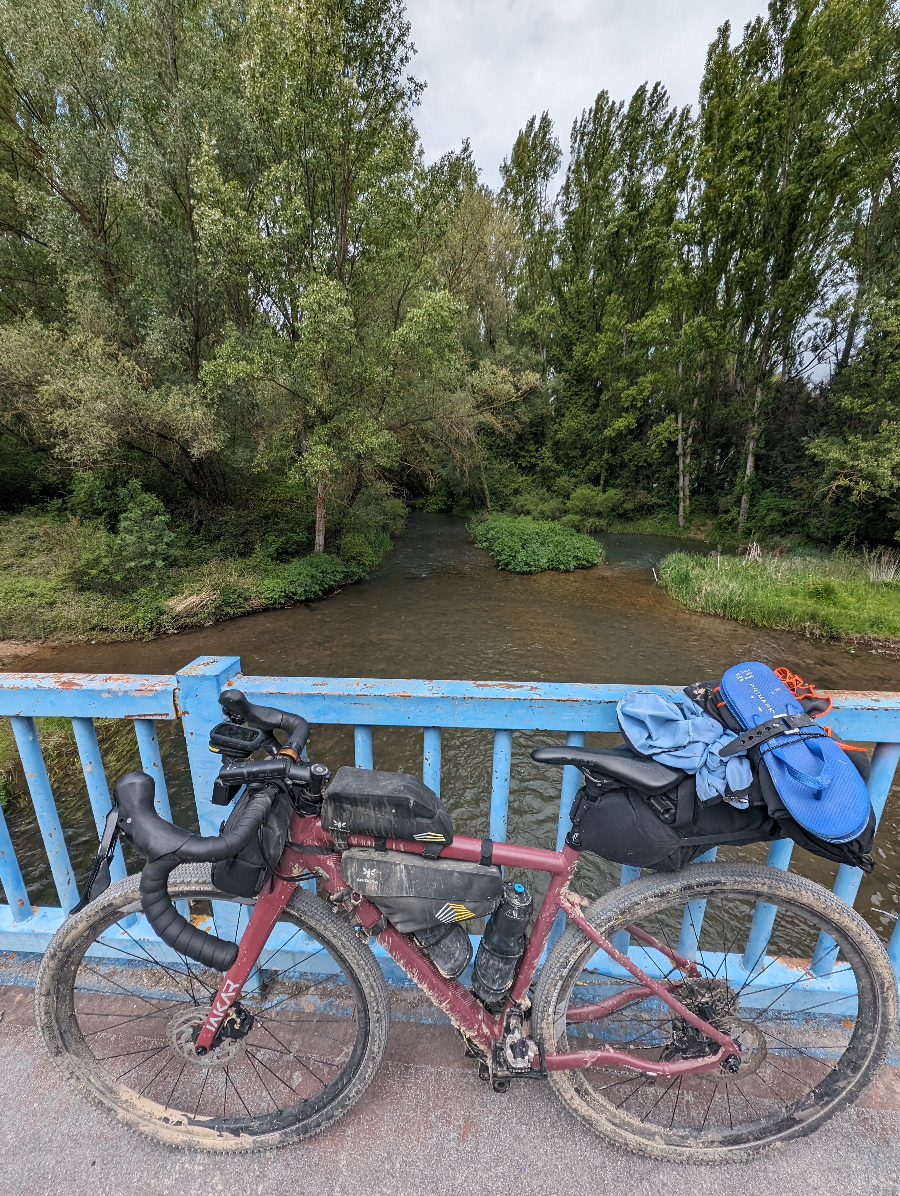
Bridge over Arlanzón river
However, it is impossible to pass by without visiting the Cathedral, one of the architectural jewels of the Camino Francés. So, I detour to pass by it. I try to get a stamp at the Cathedral, but there is such a long queue that I give up.
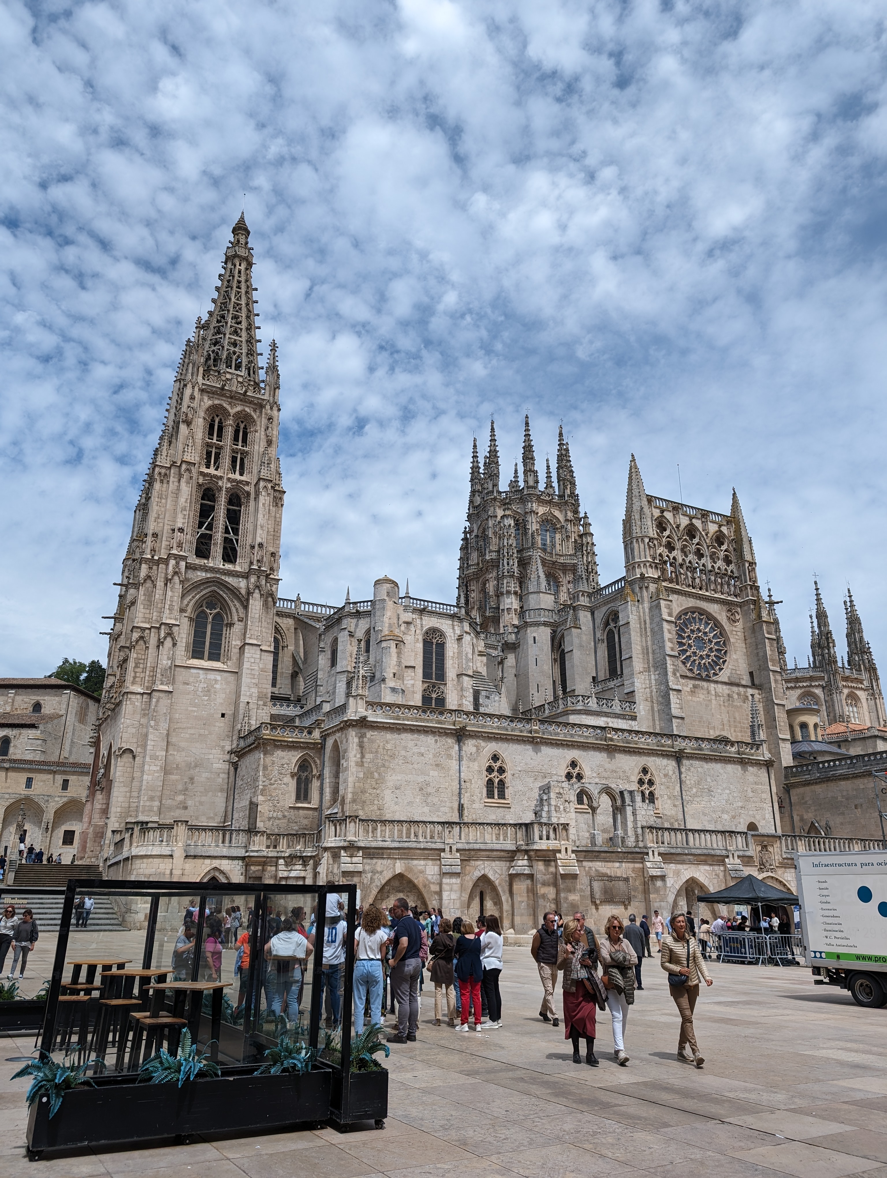
Cathedral of Saint Mary of Burgos
I sit on a nearby terrace and order a salad; but, for whatever reason, I still can’t eat. I can’t get any food down, and it’s clear that this way I won’t get very far. But there’s no choice but to continue, so I head back to the park and bike lane to leave Burgos.
In Tardajos, I pass by a small monument in memory of Mariano Díez Tobar, a fascinating character I discovered on my previous Camino in Villafranca del Bierzo. A friar, scientist, and inventor, his life is very interesting.
Very close to Tardajos is Rabé de las Calzadas. At the exit, I find a surprising construction:
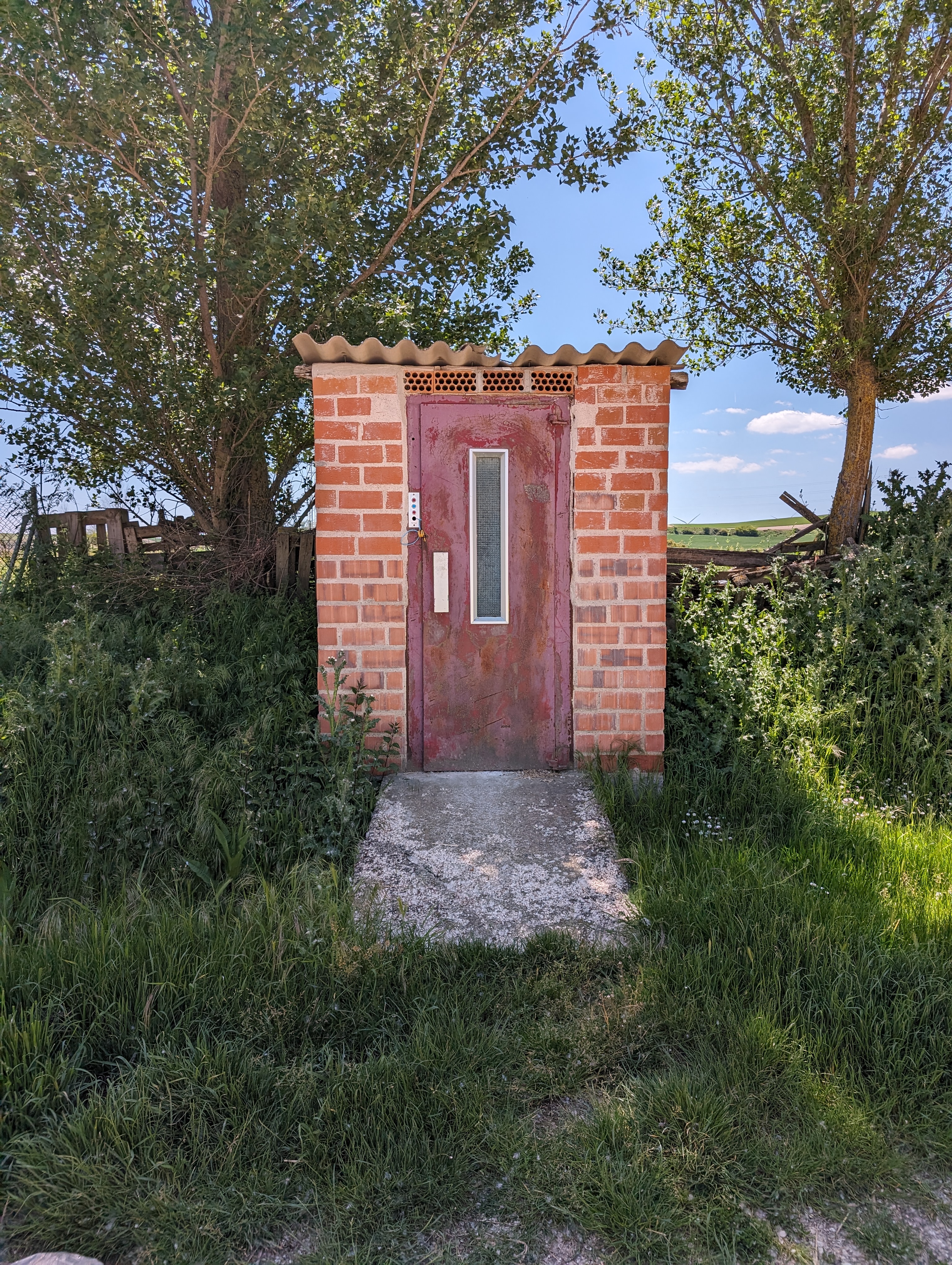
What is this?
It looks like a secret entrance to the T.I.A. or CONTROL offices, so I wait a while to see if Mortadelo and Filemón or Maxwell Smart appear; without success, of course, because they are spies and well-prepared to go unnoticed.
Already on the Castilian Meseta, one would expect the terrain to be flat. But nothing could be more untrue; this area is still very hilly. On the way to Hornillos, you climb the Alto de Matamulos, from which there are beautiful and wide views of the Castilian landscape. Already in Hornillos del Camino, I stop for a Coca-Cola (it’s very hot) and start looking for accommodation, as I’ve already cycled almost 100 kilometers.
I am just over 10 km from Hontanas but, from the previous trip, I know there’s a nice albergue a short distance before. I phone, but we don’t understand each other. Anyway, I keep going with the idea of stopping to see if I’m lucky and find a place.
The albergue is in the middle of nowhere:
Albergue Fuente Sidres
I have a very pleasant memory and funny anecdotes from that night, so I head there.
I hope to find a place because I am tired, it’s hot, I haven’t eaten, and I’ve been cycling more that 80 kilometers with headwind. Fortunately, there are some bunk beds avilable and I can stay for the night.
The owners are new (a lovely couple), but the albergue hasn’t changed much; everything is still as new, well-kept, and clean as it was two years ago. Still, I can barely eat, only a vegetable cream (delicious, by the way), and I start to blame it on having changed gel brands (something that has never to be done just before a trip…)
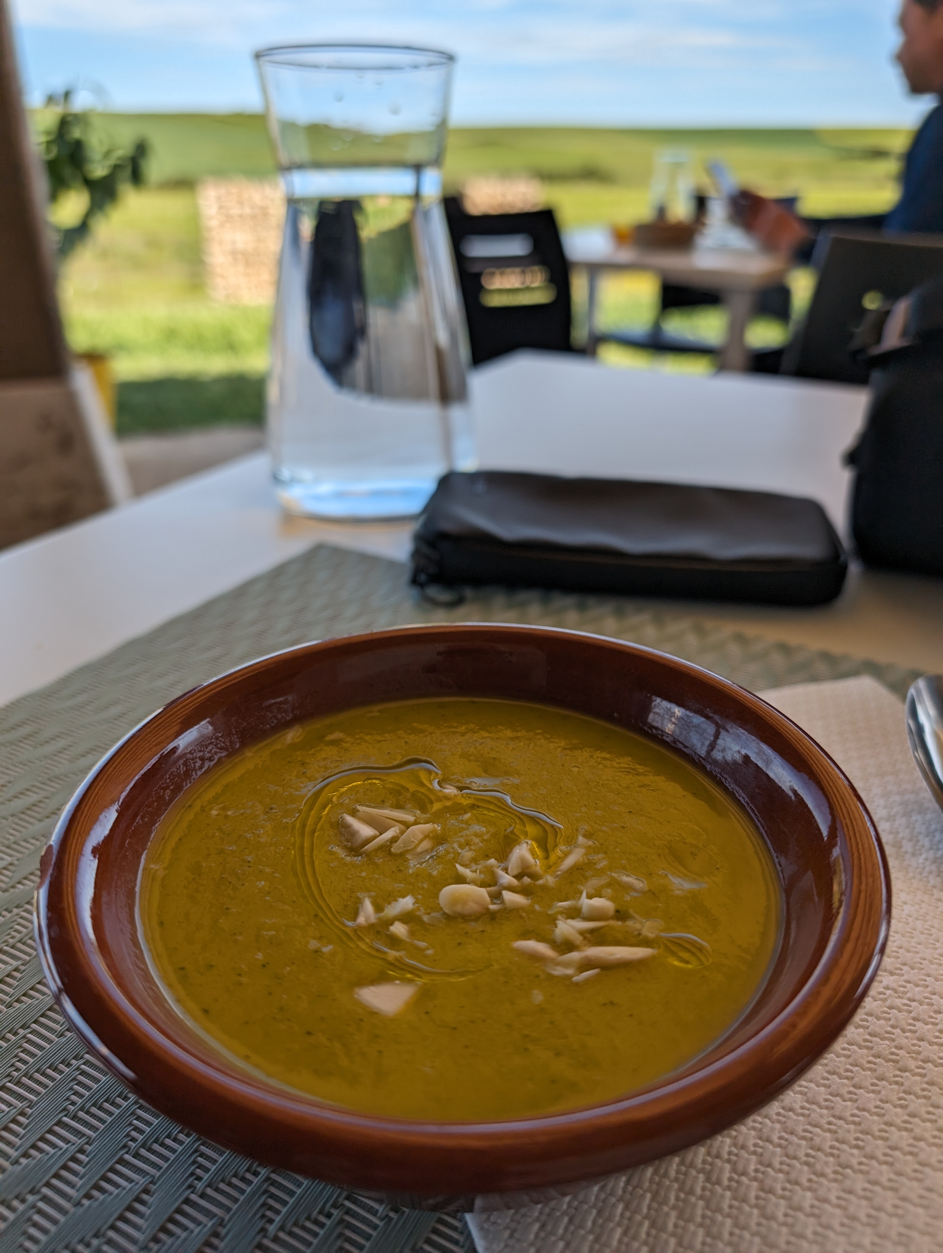
Vegetable cream
Anyway, I try to enjoy the meagre dinner I eat while admiring the surrounding landscape:
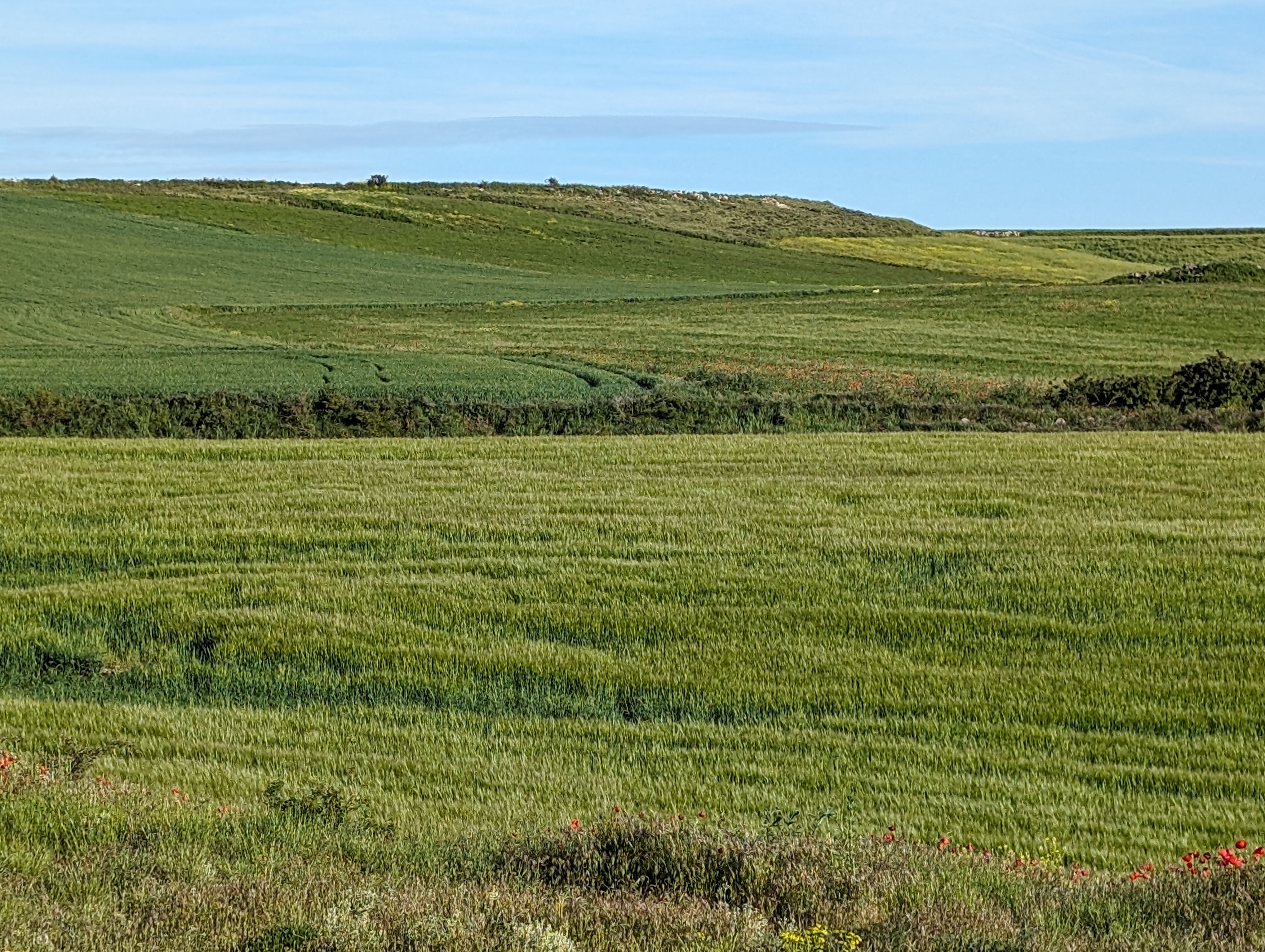
Windows 95 wallpaper
I share a room with three or four pilgrims; but, surprisingly, the night is quiet and silent, and I sleep peacefully…
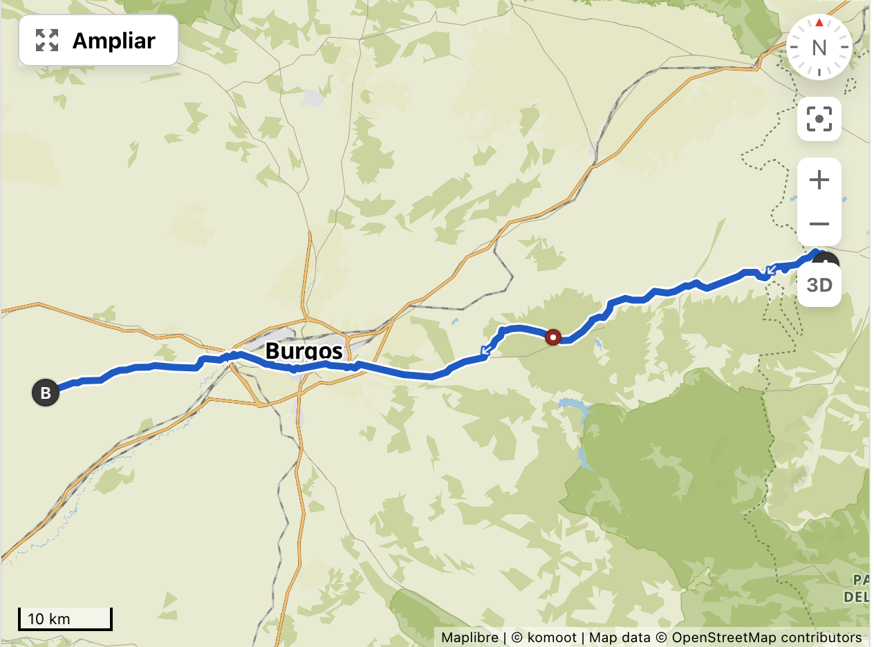
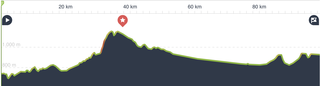
Stage Summary
- Distance: 99 kilometers
- Elevation Gain: 1100+ meters
- Time: About 9 hours, including stops
Track
Profile
👈 Day 1: from Logroño to Grañón | Día 3: from Fuente Sidres to El Burgo Ranero